Content
Abstract
These are the results for my final examination.
Essay
Description
As part of the final examination you have to write an essay on a (your) field of photography.
Results
Please see pdf for the essay (Dutch text).
Project 1 – The “new” Bijlmer
Description
The Bijlmermeer (Bijlmer for short) is an area within the Amsterdam-Zuidoost district. The area, developed between 1966 and 1975, is mostly known for its 12,500 flats; 11-storey gallery apartments situated in park-like surroundings forming hexagonal patterns. Elevated roads and centralised car parks kept the areas free of traffic, covered walkways would bring residents to their cars and homes. While initially and on paper this design sounded great (in the beginning the project even knew waiting lists), in practice, it didn't work out for various reasons. Not only did people decide to rather move to single-family houses in e.g. Lelystad and Purmerend instead of these flats, lack of public facilities (the buildings were ready way before shops, public transport etc. were put in place) made things even worse for potential owners. Add to that the much higher costs of maintenance, budget cuts, the feeling of unsafety in the public areas, and the high crime rate, and it is no wonder the whole thing started to deteriorate even before it got well under way. By 1985, one in four homes was unoccupied…
After some small scale projects to improve the quality of life in the Bijlmer between 1975 and 1990, it was decided to start a structural renovation of the whole area in 1992. This renovation included demolishing many of the high-rise flat blocks and replacing them with other forms of housing. The flats that were kept would be heavily renovated, fixing their shortcomings. Traffic was returned to ground level again, integrating it more with the rest of the area. We are now almost at the end of this renovation so it is about time we had a look at the results.
Walking through the Bijlmer, I was quite pleasantly surprised by the nice architecture and of how well everything looked, even after a few years of use. Almost as if artist's impressions had come to life. This I will reflect in the resulting images by giving them a “painterly” look.
Plan
Take images of the “old” Bijlmer in bad weather, those of the “new” Bijlmer in good weather. Process all in HDR, giving them a painterly look.
Note: For the final series, only images of the “new” Bijlmer have been used.
Results
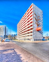 Gravestein and Geldershoofd flat blocks |
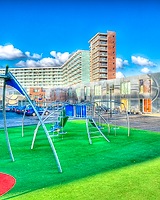 Milovan Djilasstraat with Florijn flat block in the background |
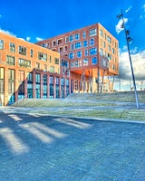 Martin Ennalsplein |
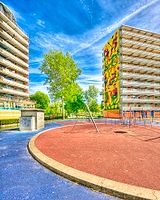 Playground between the Groeneveen and Gooioord flat blocks |
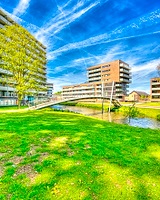 Grubbehoeve en Glitterstraat |
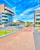 Galantstraat bicycle road |
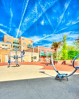 Goed Geluimdhof |
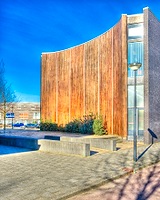 Sophie Redmondplein |
Project 2 – Limits Reached
Description
Building and Industry both have their own beauty. And even though they usually come at the cost of nature, they can also work well together with it. There are, however, limits to urbanisation. Limits that, for me, have now certainly been reached.
This is what I will try to illustrate with this series of (extreme) panoramas.
Each panorama will be taken from a piece of nature (preferably a registered natural landscape) within an urban or industrial area. A waterway acts as border.
Plan
Research candidate locations using google maps (amongst others).
Results
 Docks of the Port of Rotterdam as seen from Natural Landscape “Landtong Rozenburg” |
 Maassluis as seen from Natural Landscape “Landtong Rozenburg” |
 Docks of the Port of Amsterdam as seen from the “Noorder IJ-Polder” |
 Corus Steel plant as seen from the Locks |
 Zwijndrecht and Dordrecht harbour areas as seen from Natural Landscape “Groot Koninkrijk” |
 Noordkanaalhaven as seen from Natural Landscape “Beuningse Uiterwaarden” |
 Hartelhaven as seen from the quay, a small strip of nature on the new land made for industrial purposes |
 Maasvlakte and Europoort as seen from one of the very few unbuilt sections in the area |
 Dintelhaven as seen from the quay |


